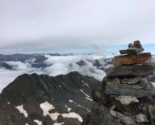
Carlit
This pyramidal-shaped mountain is the highest watchtower in the Cerdanya and the Eastern Pyrenees. This mountain, surrounded by ponds and lush vegetation, is also the most crowded in the whole Cerdanya region, especially in summer.
Technical Data
Access: From Montlluís we follow the D-118 towards La Llagona until we find, on the left, the detour of the D-60 that goes up to the Bollosa lake.
Home: La Bollosa car park.
Difficulty: Easy- Medium
Maximum altitude: 2,921 m
Elevation gain: 900m
Total duration: 4.45 h (2.30 h one way / 2.15 h return)
Time of year: Spring, summer and autumn. In winter it is a difficult route.
Notes: In the final section you will have to climb (I +) some rocks with good climbing holds. The D-60 road is closed in winter in “Pla dels Avellans”. In summer it has restricted traffic during the months of July and August you will need to get on a bus to start the route.
Route
Located next to the Bones Hores hotel car park, take the path that starts on your left (signs). We enter the forest and pass an area of granite blocks. Later, the path turns to the right and, following some very marked landmarks, we reach the Viver lake (30 min), which is located on the right. (30 min), which is located on the right.
The path continues through a wetland and passes by the Sec and Comassa lakes. Immediately we go up a small ridge that takes us to a plain from which we see the Carlit. After this plain we make a small descent and we will stop near the Vallell lake (2,143 m, 1 h).
At this key point, we cross the drain of this pond by a walkway and turn left (W). Now we have to go over some rocky steps, surrounded by grass. The path takes us to a small pass and then to the beginning of a plain, from where the Carlit seems very close. We cross an area of reddish rocks that come off the Tossal Colomer and, overcoming a steep climb, we come out to the Gelat de Subirà lake, the highest in La Cerdanya (2,598 m, 1.50 h).
We are located at the base of Carlit. We turn left and with a small climb we get to the “Collomer” pass. We walk towards the eastern edge of the mountain following a few zigzags along the way and cross a small ridge until we reach a pass, marked with a large landmark. Then we climb some parts with good climbing holds. Then, a diagonal trek and a climb on broken ground lead us directly to the mountain.
From there we just have to turn left and reach, without further difficulty, the summit of Carlit (2,921 m, 2.30 h). Exceptional panorama of the surrounding mountains and the reservoirs of Lanós and La Bollosa. The view arrives untik Canigó and Maladeta mountains.


