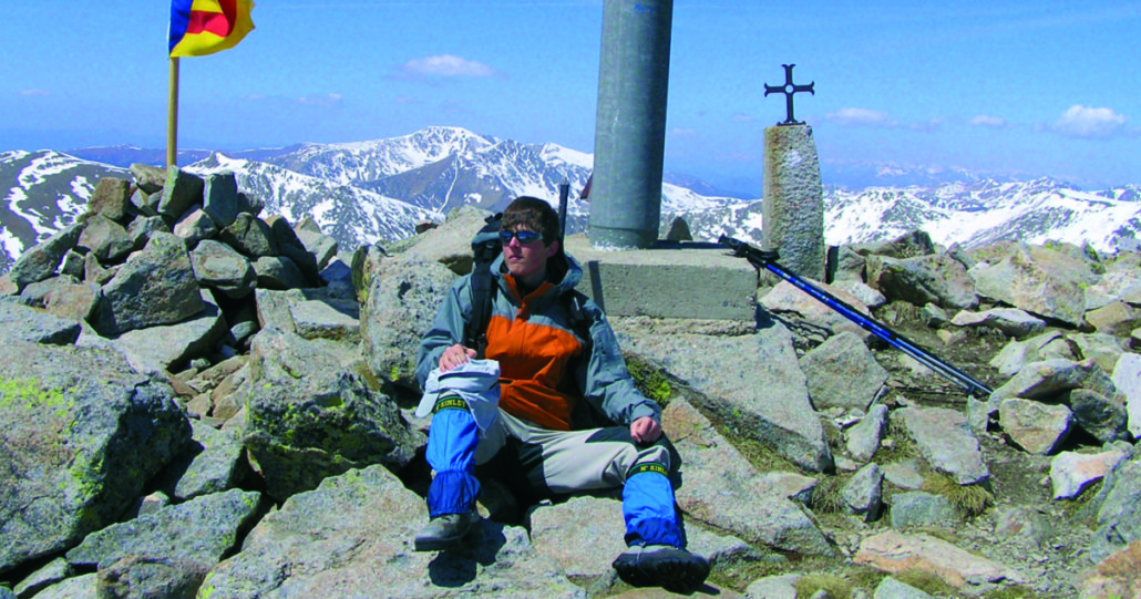
Puigpedrós
The summit of Puigpedrós, located north of the Planell de Campcardós, is an exceptional viewpoint of much of the Pyrenees mountains, as its panorama extends from the Canigó to the Maladeta mountain range, naturally passing through the highest peak in Catalonia: the Pica d’Estats.
Technical Data
Access: Both from Meranges and from Guils Fontanera Station there are forest tracks, quite passable, which take us to the site of the Malniu refuge (2,130 m)
Home: car park at the Malniu refuge (2,130 m)
Difficulty: Easy- Medium
Maximum altitude: 2,914 m
Elevation gain: 784 m
Total duration: 3.30 h (2 h one way / 1.30 h return)
Season: Late spring, summer and autumn.
Notes: The track from Guils Fontanera is closed in winter. Also the track that goes up from the town of Meranges often becomes impassable at this time due to the accumulation of snow, which we must take into account for the approach.
Route
From the Malniu refuge we start the path following the GR11 signs in the W direction to cross a wooden walkway that saves the drain of the Sec lake. We immediately go out to a wide meadow, which we cross in the same direction, and which soon makes us gain height through an area with some granite rocks, until we reach a wooden pole with indicators.
From here, we leave the GR11 path on the right, which would take us to the Engorgs refuge and, following the signs, turn left (NO) and begin to climb through a grassy area. by some streams that go down from the les Molleres pass. The path turns north with a steep climb and goes up the grassy ridge until it finishes in a flatter area of pasture.
It is time to cross this false plane diagonally following the stream that goes down to the right (NNE) and that will guide us for a stretch of the path, as it comes from the Campcardós Planell. Following the landmarks we find a steep slope down the stream. Leaving it on the right, we go over the steep climb, crossing some rocky areas, until we reach the southern part of the Planell de Campcardós (1.15 am), a vast plain in which the dome of the mountain to which we are heading stands out.
We cross the plain, which gradually gains height, in a NE direction, towards the pile of stones that forms the summit of Puigpedrós.
When we reach the base of the mountain, we dodge the final rocky ground on the right, and reach the top of Puigpedrós (2,914 m, 2 h), with a cross and a geodesic vertex at the highest point. If we go further north, apart from the immense perspective of the Pyrenees mountains and the nearby peaks of Andorra, we can see the whole depression that forms the Campcardós valley until we reach the village of Porta.
The return can be done by the same path we went up or down the Vall de Campcardós and passing by Lake Malniu.


